
Places / South America / Guyana
Linden
Not been yet
At a glance
- Country
- Guyana
- Region
- Upper Demerara-Berbice
- Population
- 27,000
- Best time to go
- September to November, February to April
- Main airport
- None — nearest is Cheddi Jagan International (GEO)
- Coordinates
- 6.00°N, 58.30°W
Visited Still to go Click a pin or country to read more. Zoom with + and −, a double-click or a pinch.
Overview
Linden is Guyana's second town, built around bauxite mining on both banks of the Demerara River, a couple of hours inland from Georgetown. It was formed by joining the communities of Mackenzie and Wismar, linked by a bridge.
It is a working town rather than a tourist destination, but it sits at the start of the road to the interior. Most travellers pass through on the way south, and a stop gives a glimpse of the country beyond the coast.
Things to see
-
The Demerara River
The wide, dark river that divides the town, busy with boats and framed by forest on the far bank.
-
Mackenzie–Wismar Bridge
The bridge joining the two halves of town, with good views up and down the river.
-
Blue lakes
Old mining pits on the edge of town that have filled with strikingly blue water.
Things to do
-
Learn about the bauxite industry
Look out across the mining landscape that shaped the town and gave it its name in honour of Forbes Burnham.
-
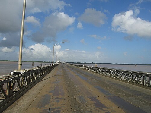
Photo: No machine-readable author provided. FrWaters assumed (based, CC BY 2.5 River trip
Ask locally about boats along the Demerara to see riverside villages and forest.
-
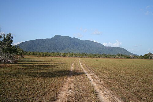
Photo: Treez44est, CC BY-SA 2.0 Head for the interior
Linden is the start of the long road south towards Lethem and the Rupununi savannahs.
Where to stay
Mackenzie
The east-bank side, with most of the town's services and simple hotels.
Hotels in MackenzieWismar
The west bank, quieter and residential, with a few guesthouses.
Hotels in Wismar
Getting around
Taxis and minibuses link the two sides of town. Most places are a short ride from the bridge.
Minibuses run along the Linden–Soesdyke Highway from Georgetown, taking around two hours.
When to go
The drier months of September to November and February to April are best. The main rains fall from May to August, making roads to the interior much harder.
Plan your trip to Linden
Guide last checked October 2026. Opening times and prices change, so check before you go.