
Places / South America / Bolivia
La Paz
Visited in December 2015
At a glance
- Country
- Bolivia
- Region
- La Paz Department
- Population
- 755,732
- Best time to go
- May to October
- Main airport
- El Alto International (LPB)
- Coordinates
- 16.50°S, 68.13°W
Country visited City visited Still to go Click a pin or country to read more. Zoom with + and −, a double-click or a pinch.
Overview
La Paz fills a deep canyon below the Altiplano, with houses climbing the walls towards the rim and the snowy peak of Illimani watching over it all. At around 3,600 metres it is the seat of Bolivia's government, while Sucre is the constitutional capital.
It is a city of sharp contrasts: cholitas in bowler hats, street markets, modern cable cars and an excellent restaurant scene. Take the first day slowly to adjust to the altitude.
Things to see
-
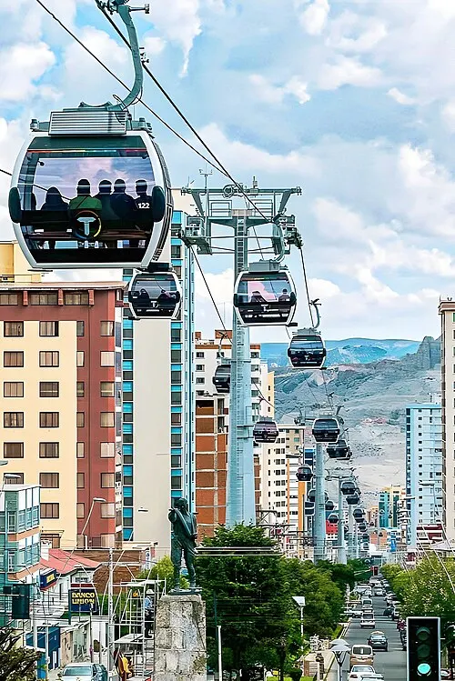
Photo: Parallelepiped09, CC BY-SA 4.0 Mi Teleférico
The urban cable car network, the best way to see the city's extraordinary setting from above.
Tickets and tours -
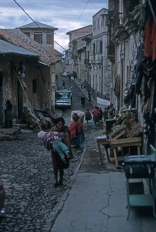
Photo: JERRYE AND ROY KLOTZ MD, CC BY-SA 3.0 Witches' Market
Stalls of herbs, amulets and dried llama foetuses used in offerings to Pachamama, near Calle Sagárnaga.
-
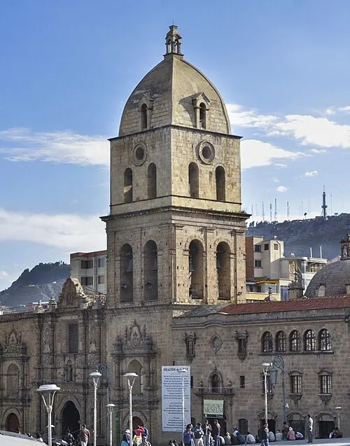
Photo: EEJCC, CC BY-SA 4.0 Basilica of San Francisco
A sixteenth-century church with a carved stone façade mixing Spanish and indigenous motifs.
-
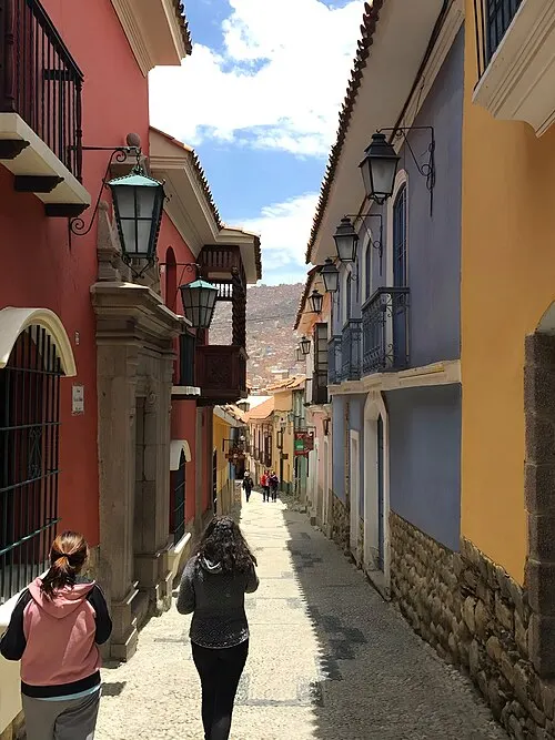
Photo: Parallelepiped09, CC BY-SA 4.0 Calle Jaén
The best-preserved colonial street, lined with small museums and painted balconies.
-
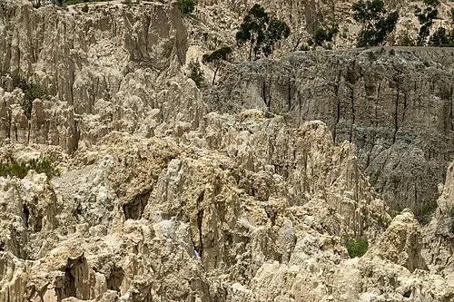
Photo: PsamatheM, CC BY-SA 4.0 Valle de la Luna
A small, eerie landscape of eroded clay pinnacles on the city's southern edge.
Tickets and tours
Things to do
-
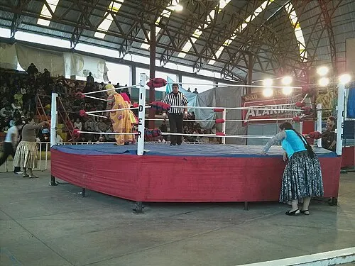
Photo: User:Jdlrobson, CC BY-SA 3.0 Cholita wrestling
Watch the cholitas luchadoras fight in full skirts in El Alto; theatrical, raucous and a lot of fun.
Find tours -
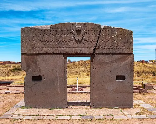
Photo: CLAUDIOLD, CC BY-SA 4.0 Day trip to Tiwanaku
The ruins of a great pre-Inca civilisation on the Altiplano, with the famous Gateway of the Sun.
Find tours -
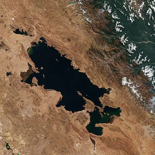
Photo: European Space Agency, Attribution Lake Titicaca
Travel to Copacabana and take a boat to the Isla del Sol for Inca ruins and walks above the deep-blue lake.
-
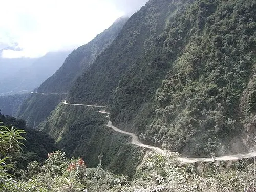
Photo: celineo, CC BY 2.0 Cycle the Yungas Road
Join an organised mountain-bike descent down the old 'Death Road' from icy passes into the subtropical Yungas.
Find tours
Where to stay
Centro
Around Sagárnaga and San Francisco, central and full of budget hotels and tour agencies.
Hotels in CentroSopocachi
A leafy, bohemian neighbourhood of cafés and bars, slightly lower and calmer.
Hotels in SopocachiZona Sur
The lower, warmer southern suburbs, with upmarket hotels and restaurants.
Hotels in Zona Sur
Getting around
The cable car lines are fast, cheap and spectacular. Taxis are plentiful; use radio taxis or apps rather than hailing cars on the street.
El Alto airport sits on the plateau above the city, about 30 to 45 minutes by taxi to the centre.
When to go
May to October is the dry season, with clear blue skies but very cold nights. November to March brings afternoon rain. Altitude is the main challenge year-round, so allow time to acclimatise.
Plan your trip to La Paz
- HotelsBooking.com
- Tours and ticketsGetYourGuide
- FlightsKiwi.com
- Attraction ticketsTiqets
- Airport parking, lounges and transfersHoliday Extras
- Car hireAuto Europe
- Mobile data (eSIM)AiraloCode DAN9406 for money off
- GuidebooksAmazon
Some of these are affiliate links: if you book through them I may earn a small commission, at no extra cost to you. More about this.
Guide last checked October 2026. Opening times and prices change, so check before you go.